September 15, 2026
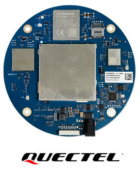
Quectel’s QLM290P (03) combines quad-band, multi-constellation GNSS, RTK positioning, global LTE and LoRa connectivity in one integrated smart antenna platform. It simultaneously supports L1, L2, L5 and E6 GNSS signals and can provide real-time centimetre-level positioning using RTK corrections over LTE. Where cellular coverage is unavailable, LoRa can be used for short-range point-to-point communication between base and rover stations.
Obtaining a position from GNSS is relatively straightforward. Maintaining high-precision positioning in a real application is considerably more demanding.
A precision positioning system may need to receive signals from several satellite constellations and frequency bands, process RTK corrections, maintain a reliable data connection and deal with interference, obstructions and changing operating environments.
The connectivity path for those correction data also matters. In one application, an LTE network may be continuously available. In another, the equipment may operate in a remote location where cellular coverage cannot be assumed.
Quectel addresses these requirements with the QLM290P (03), bringing the GNSS receiver, RTK functionality, antenna and two different communication technologies together in one smart antenna device.
For us at TOP-electronics, that integration is what makes this product particularly interesting. Instead of looking at high-precision GNSS, correction delivery, cellular communication and the antenna as four separate design tasks, engineers can start from a more integrated positioning platform.
At the heart of the QLM290P is Quectel’s LG290P (03) high-precision GNSS technology.
The smart antenna supports concurrent reception of L1, L2, L5 and E6 signals and multiple global and regional satellite constellations, including:
It also supports SBAS services including WAAS, EGNOS, BDSBAS, MSAS, GAGAN and SDCM.
Receiving several frequencies and constellations gives the positioning engine more satellite and signal information to work with, which is particularly relevant when equipment is operating in environments where satellite visibility is less than ideal.
Quectel specifically positions the underlying quad-band RTK architecture for challenging conditions such as urban canyons and heavily obstructed environments.
Standard standalone GNSS typically does not provide sufficient accuracy for applications such as surveying, machine guidance or precision agriculture.
The QLM290P therefore integrates RTK, Real-Time Kinematic, positioning.
RTK uses correction information from a known reference source to correct errors in the satellite measurements received by the rover. Quectel states that, when operating as a rover station and receiving correction information through its built-in LTE connection, the QLM290P can provide real-time, continuous centimetre-level positioning.
This is an important distinction.
The GNSS receiver determines the position, but the communication path carrying the correction data is part of the complete positioning architecture. A high-precision receiver without access to the required correction stream will not magically produce an RTK fix simply because RTK appears in the datasheet.
The QLM290P incorporates a global-version LTE module alongside its GNSS functionality.
This allows the device to connect to RTK correction services over the cellular network, giving the rover access to correction data without requiring a local physical connection to a base station.
For applications deployed across large areas, this can simplify the positioning architecture considerably.
Equipment such as agricultural machinery, surveying systems or mobile industrial assets can obtain both GNSS information and the required remote correction data through the same integrated platform.
LTE is useful when network coverage exists. Some precision-positioning applications, however, tend to operate exactly where the nearest mobile base station is not particularly cooperative.
For these situations, the QLM290P also integrates LoRa communication.
Quectel specifies operation over the 863 to 928 MHz LoRa band and supports deployment of short-range base and rover stations using point-to-point communication. This provides an alternative path for transmitting correction information in locations where cellular coverage is unavailable.
That gives system designers two fundamentally different communication options within the same positioning platform:
LTE for access to corrections over a wide-area cellular network, and LoRa for local base-to-rover communication.
For a field system that may be deployed in several different environments, that flexibility can be more important than another decimal place in an isolated GNSS specification.
The QLM290P is not just a collection of communication modules.
Quectel integrates a high-performance full-frequency GNSS antenna into the device and includes diplexer and SAW filtering to improve anti-interference performance.
This matters because high-precision positioning performance is strongly dependent on the RF environment.
The receiver may be capable of processing four GNSS bands, but antenna performance, placement and interference from surrounding electronics still have a direct influence on the quality of the signals reaching it.
Bringing the antenna and GNSS platform together allows more of this RF chain to be controlled as part of the complete product rather than leaving every element to the system designer.
The positioning result still needs to reach the rest of the machine or control system.
Quectel therefore supports several wired interface options:
These interfaces make the QLM290P particularly practical for integration into industrial equipment and machines where serial interfaces remain common.
RS-422 and RS-485 are especially relevant when the antenna or positioning unit cannot be located directly next to the main controller and communication needs to cross a more electrically demanding environment.
Quectel specifies the QLM290P as a 120 mm diameter device with an approximate weight of 220 g and an operating temperature range from -40 to +85 °C.
The stated application areas include:
What these applications have in common is that positioning accuracy cannot be considered separately from connectivity and deployment conditions.
A surveying receiver, for example, may need continuous corrections across a worksite. Agricultural equipment may operate far from normal infrastructure. A mining application may have to deal with restricted sky visibility and an electrically difficult environment.
The QLM290P brings several of the technologies needed to address those conditions into one device.
| Feature | QLM290P (03) |
|---|---|
| Positioning | Multi-constellation GNSS with RTK |
| GNSS bands | L1, L2, L5 and E6 |
| Constellations | GPS, GLONASS, Galileo, BDS, QZSS, NavIC |
| SBAS | WAAS, EGNOS, BDSBAS, MSAS, GAGAN, SDCM |
| Long-range connectivity | LTE |
| Local connectivity | LoRa, 863–928 MHz |
| Antenna | Integrated full-frequency GNSS antenna |
| Interfaces | RS-422, RS-485, RS-232 or UART TTL |
| Diameter | 120 mm |
| Weight | Approx. 220 g |
| Operating temperature | -40 to +85 °C |
Specifications according to Quectel’s current QLM290P (03) product information.
For us at TOP-electronics, the main advantage of the QLM290P is not simply the number of technologies integrated into the product.
It is the way those technologies work together around the actual application.
A high-precision GNSS design needs more than satellite reception. The designer also needs to consider:
Where do the RTK corrections come from? How are they transported to the rover? What happens when LTE coverage disappears? Which interface connects the positioning system to the host controller? And how will the antenna perform in the final installation?
The QLM290P addresses several of those questions within one platform.
That can reduce the amount of separate hardware that needs to be selected and integrated while giving developers a choice between LTE-based corrections and local LoRa communication.
It does not eliminate the need for careful system engineering, but it does reduce the number of separate pieces that have to be persuaded to work together.
Selecting a precision GNSS solution should start with the actual positioning requirement rather than simply specifying "RTK".
At TOP-electronics, we would first look at parameters such as the required accuracy, operating environment, satellite visibility, availability of LTE coverage, correction service, base-to-rover distance, required host interface and mechanical integration.
For some systems, a separate GNSS module, modem and antenna architecture will still make sense. For others, an integrated platform such as the Quectel QLM290P can significantly simplify the system architecture.
If you are developing a positioning system for agriculture, surveying, mapping, mining, machine guidance or another high-precision application, our technical team can help you evaluate the right GNSS, RTK, antenna and connectivity architecture.
Back